Western Europe Pictures, Images and Stock Photos
Browse 260+ western europe stock photos and images available, or search for western europe map or map of western europe to find more great stock photos and pictures.
Most popular
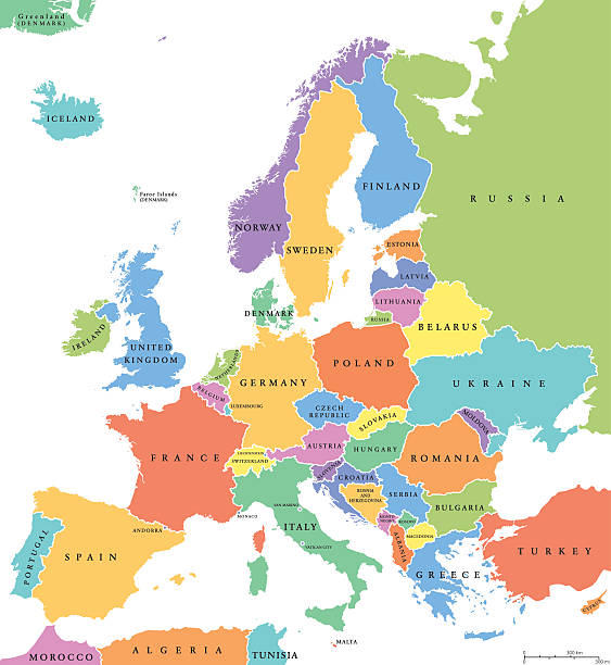
Europe single states political map. All countries in different colors, with national borders and country names. English labeling and scaling. Illustration on white background.
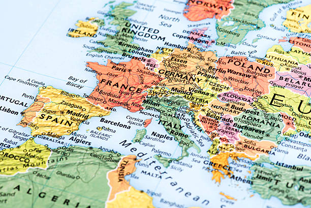
Map of Europe. Detail from the World Atlas.
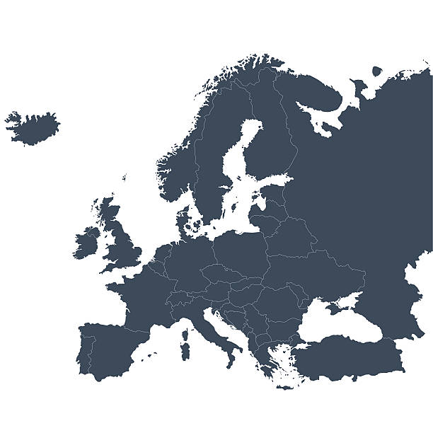
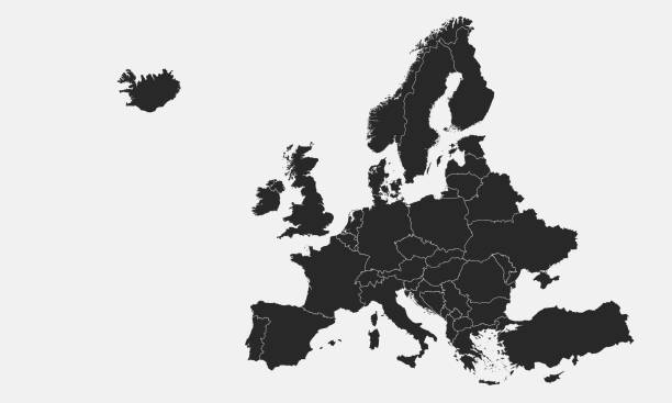
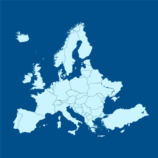
A graphic illustrated vector image showing the outline of the Europe. The outline of the country is filled with a dark navy blue colour and is on a plain white background. The border of the country is a detailed path.

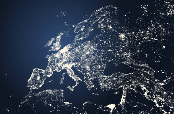
Europe from space at night with city lights showing European cities in Germany, France, Spain, Italy and United Kingdom (UK), global overview, 3d rendering of planet Earth, elements from NASA. Some elements from NASA (https://eoimages.gsfc.nasa.gov/images/imagerecords/57000/57752/land_shallow_topo_2048.jpg)
Vector illustration
Highly detailed colored vector illustration of Europe map -.borders, countries and cities - illustration.

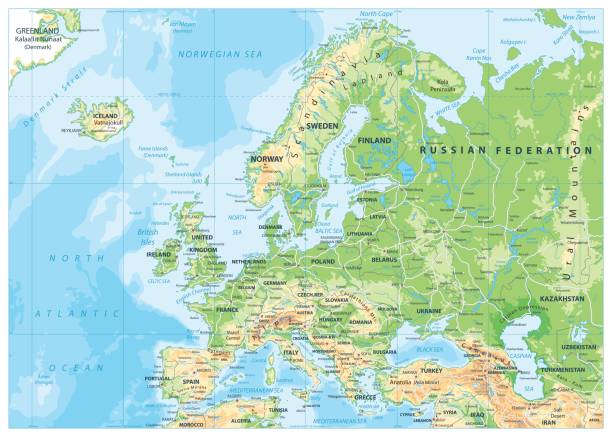
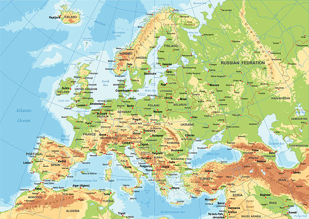
Europe Physical Map. Detailed vector illustration of Europe Physical Map.
Highly detailed map of Europe for your design and product.
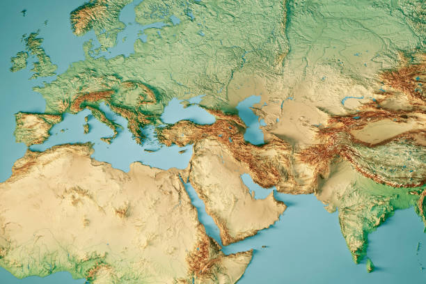
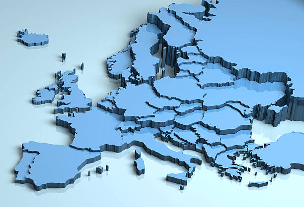
3D Render of a Topographic Map of Europe, India and Middle East. All source data is in the public domain. Color and Water texture: Made with Natural Earth. http://www.naturalearthdata.com/downloads/10m-raster-data/10m-cross-blend-hypso/ http://www.naturalearthdata.com/downloads/110m-physical-vectors/ Relief texture: GMTED 2010 data courtesy of USGS. URL of source image: https://topotools.cr.usgs.gov/gmted_viewer/viewer.htm
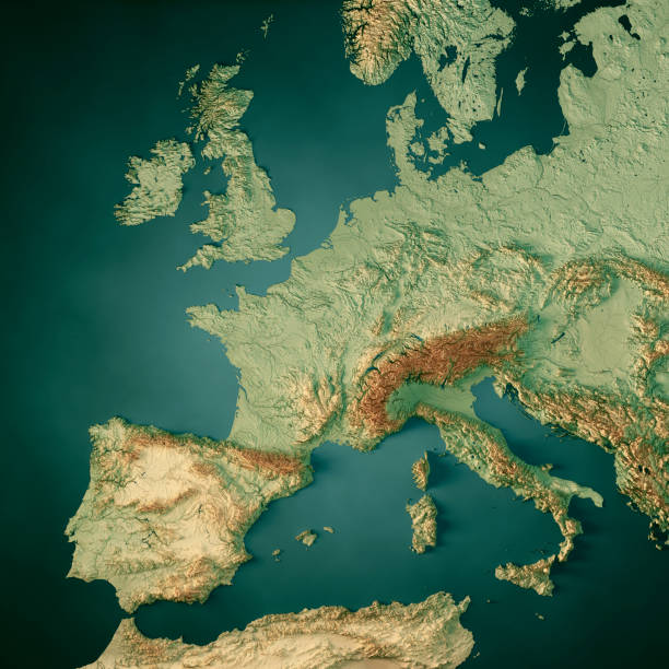
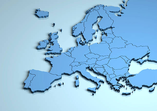
3D Render of a Topographic Map of Western Europe. All source data is in the public domain. Color texture and Water: Made with Natural Earth. http://www.naturalearthdata.com/downloads/10m-raster-data/10m-cross-blend-hypso/ http://www.naturalearthdata.com/downloads/10m-physical-vectors/ Relief texture: GMTED 2010 data courtesy of USGS. URL of source image: https://topotools.cr.usgs.gov/gmted_viewer/viewer.htm

Aerial view of London and the Tower Bridge, England, United Kingdom

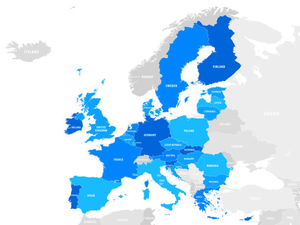
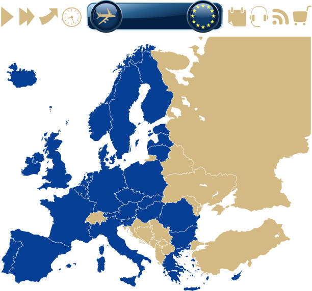
Map of the European Union. Vector illustration in HD very easy to make edits.
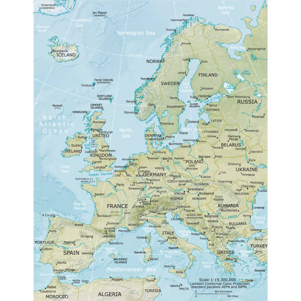
Vector illustration of the physical map of Europe Reference map was created by the US Central Intelligence Agency and is available as a public domain map at the University of Texas Libraries website. https://www.cia.gov/library/publications/resources/the-world-factbook/graphics/ref_maps/physical/pdf/europe.pdf
![Europe map Europe map.Source: "World reference atlas"
[url=/search/lightbox/5890567][IMG]http://farm4.static.flickr.com/3574/3366761342_e502f57f15.jpg?v=0[/IMG][/url] western europe stock pictures, royalty-free photos & images](https://media.istockphoto.com/id/110924644/photo/europe-map.jpg?s=612x612&w=0&k=20&c=Mtgn8ExOWOVi2J_HNMaZD2JLJALDXHS34pREoh1RZWo=)
Europe map.Source: "World reference atlas" [url=/search/lightbox/5890567][IMG]http://farm4.static.flickr.com/3574/3366761342_e502f57f15.jpg?v=0[/IMG][/url]

CLICK ON LIGHTBOXES BELOW TO VIEW MORE RELATED IMAGES:

european countries 3d illustration - european continent marked with flags

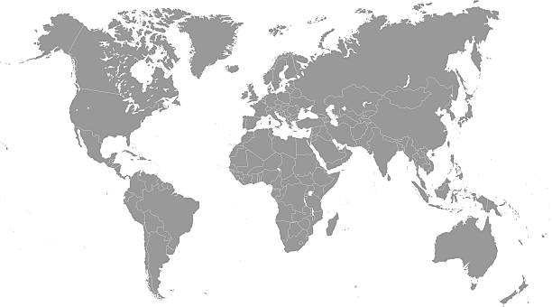
A transparent world map, a set of the earth on white background without the ocean, an isolated illustration


Europe and surrounding areas seen from space. Perfectly usable for topics like global business or European economy and culture. High quality 3D rendered image made from ultra high res 20k textures by NASA: https://visibleearth.nasa.gov/images/55167/earths-city-lights, https://visibleearth.nasa.gov/images/73934/topography, https://visibleearth.nasa.gov/images/57747/blue-marble-clouds/77558l

Blue Globe viewing from space at night with connections between cities. (World Map Courtesy of NASA: https://visibleearth.nasa.gov/view.php?id=55167)
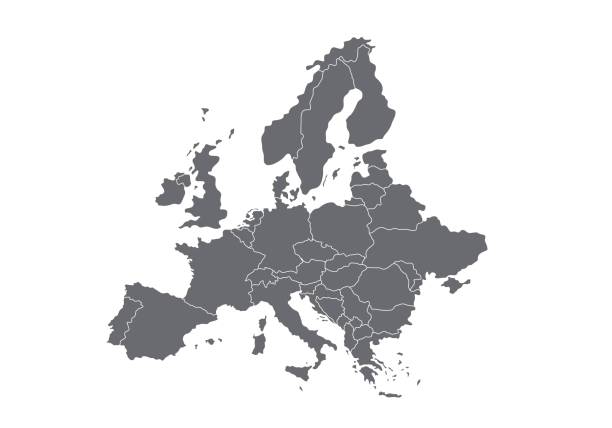
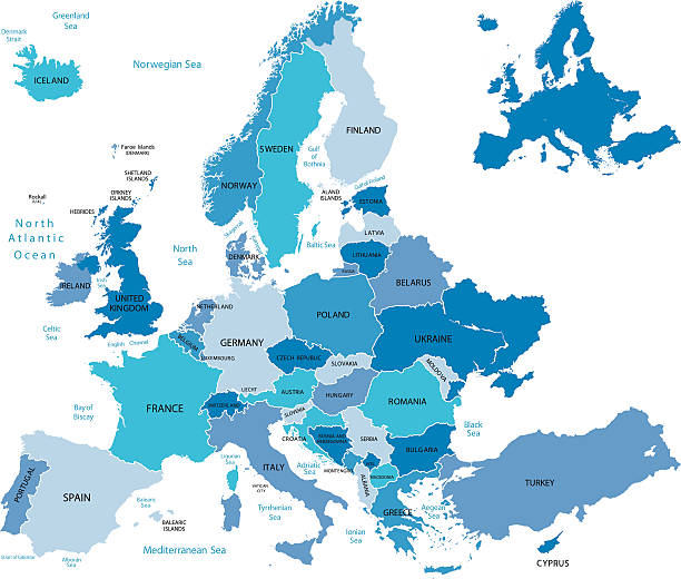
High quality map Europe with borders of regions. Stock vector

Venice is a city in northeastern Italy and the capital of the Veneto region. It is situated across a group of 118 small islands that are separated by canals.

Abstract design with famous landmarks. Vector illustration. Modern design template. File is saved in AI10 EPS version. This illustration contains a transparency

vector of the Europe map
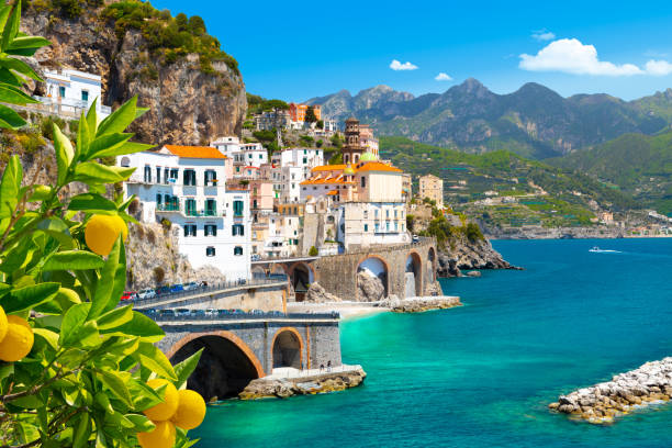
Morning view of Amalfi cityscape on coast line of mediterranean sea, Italy

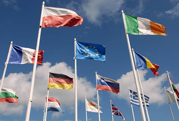
international flags

Vector illustration
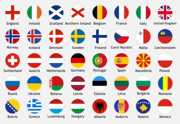
National flags of european countries with captions. Set of vector icons illustration for national events, travel and holidays.
Vector map of Europe, including Russia, with clear country borders

Map of Europe - Highly Detailed Vector illustration
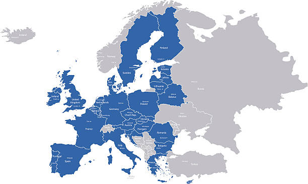
A map with European Union countries and their capitals.
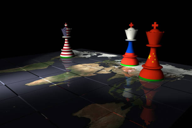
Render of a chessboard decorated a map of the earth and with pieces decorated with the American, Chinese and Russian flags. The Earth map is a public domain image from NASA's Visible Earth project: https://visibleearth.nasa.gov/view.php?id=73884
Europe map with Spain, France, Germany, Poland, Sweden and Norway Map was found: http://legacy.lib.utexas.edu/maps/europe/txu-oclc-247233313-europe_pol_2008.jpg Created with Adobe Illustrator with splines 11-12-2019
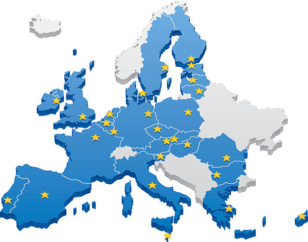
Map of the European Union. Capitals and borders can be easily removed in the vector file.
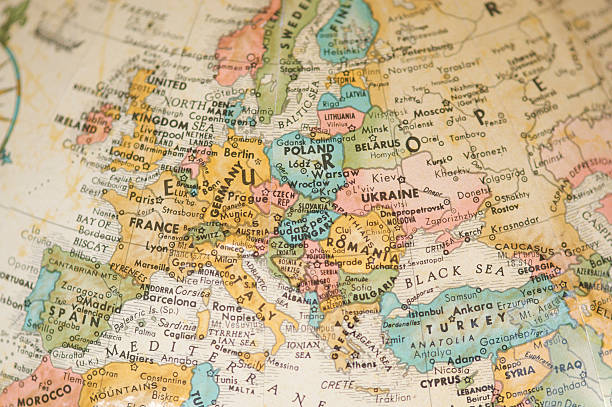
Selective focus view of vintage antique map of Europe on a faded sepia antique globe

Source maps reference:

Summer background - blue sky with bright sun and thermometer

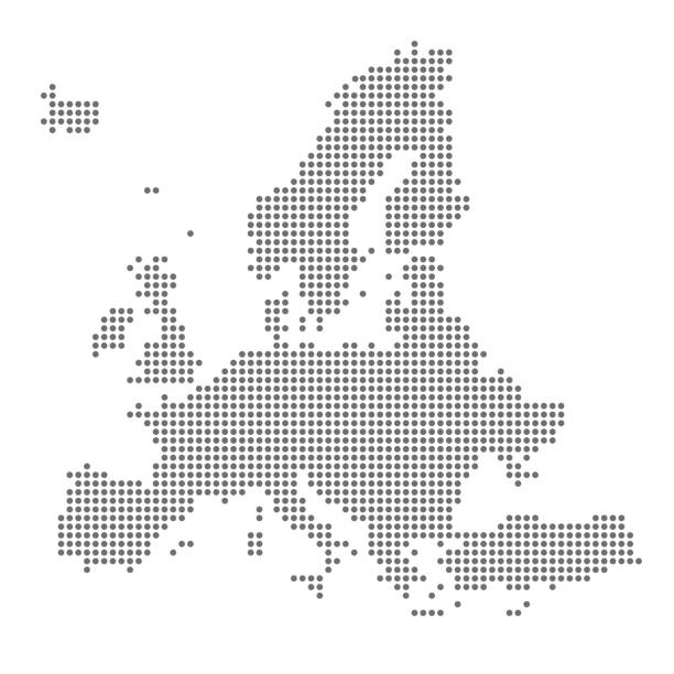
A simple vector dot (pop) map of Great Britain and Ireland
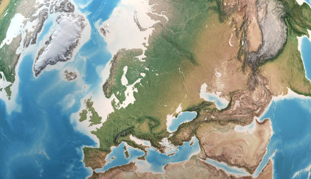
Physical map of Europe, Greenland, Middle East and Asia, with high resolution details. Satellite view of Planet Earth. 3D illustration - Elements of this image furnished by NASA

Ukraine political map with capital Kiev, national borders, important cities, rivers and lakes. English labeling and scaling. Illustration.
vector of the Europe map

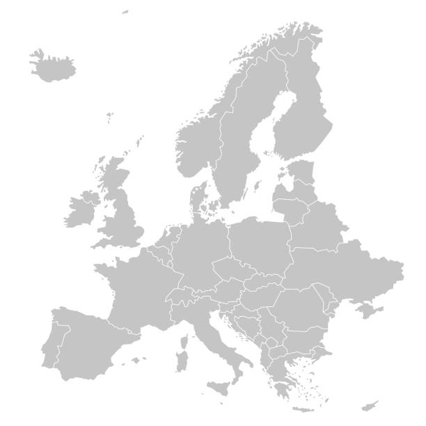
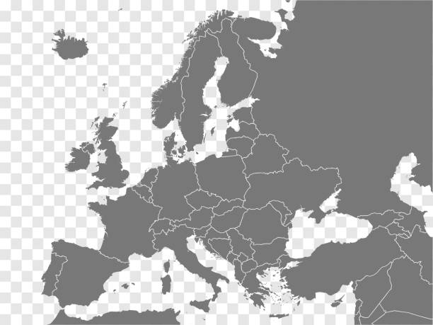
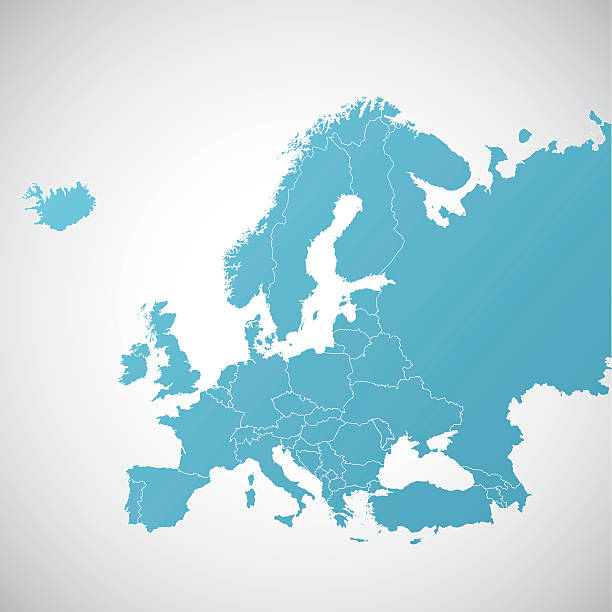
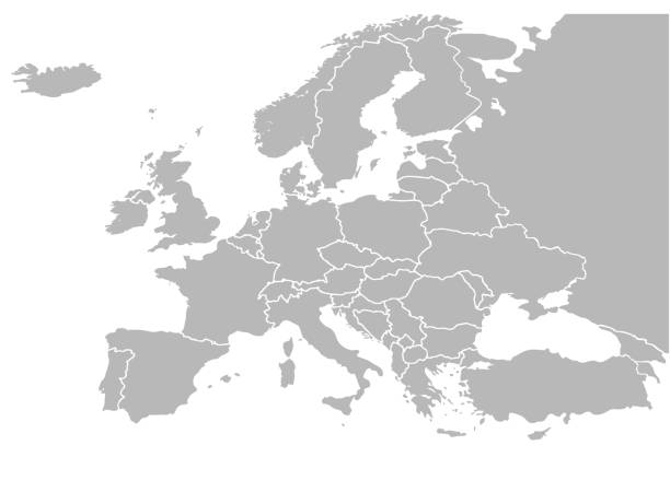
White map of Europe isolated on a gray background with a long shadow effect and in a flat design style. Vector Illustration (EPS10, well layered and grouped). Easy to edit, manipulate, resize or colorize.

Portrait of a young scandinavian girl in the city center during a winter day

Vector Illustration World Map on White Background. Courtesy of the PCL Map Collection: http://www.lib.utexas.edu/maps/world.html (Public Domain PCL Map Collection).
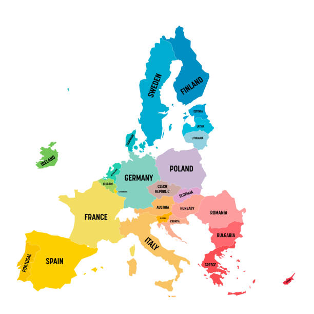
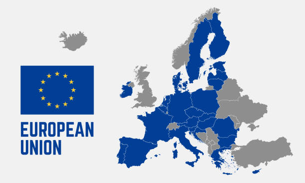
Colorful vector map of EU, European Union. Member states after brexit in 2020.

Shambles is probably the most famous street in York. Shambles has been a Shopping street since Tudor times and remains almost unchanged to this day and attracts tourists in the thousands.There are people in the scene but none of them are recognisable due to a slow shutter speed. Although the sky is white it was almost the last light of the day. The street was very dark and the lights were coming on.

Earth view from space at night with lights and connections from cities. (World Map Courtesy of NASA: https://visibleearth.nasa.gov/view.php?id=55167)
drawn and computer design of vector map of europe with symbols. date of creation:27. 08. 2011 layers used: outlines .maps and the borders of country layers separately. created by illustrator cs3. source of map: http://www.lib.utexas.edu/maps/europe/txu-oclc-247233313-europe_pol_2008.jpg and http://www.lib.utexas.edu/maps/world_maps/txu-oclc-264266980-world_pol_2008-2.jpg